

Theme park guest wayfinding signage has to do more than point toward rides. It helps visitors understand where they are, choose a route, find essential services, and recover when a path or plan changes. A useful plan begins with the guest journey, then coordinates sign locations, content, accessibility, approvals, installation, and maintenance as one connected system.
Discuss your park signage project
What should a theme park wayfinding system help guests do?
Start by defining the decisions guests need to make, not by choosing sign shapes. A visitor may need to decide which entrance to use, where to turn at a fork, whether a route leads to an attraction or a service, and how to return to a central destination. Each sign should answer a real question at the point where a guest needs the answer.
Map the experience from arrival through departure. Include parking or drop-off areas, entry screening, the entrance plaza, major paths, attraction approaches, dining and rest areas, restrooms, first aid, guest services, and exits. The precise destinations will vary by property, but the planning method is the same: identify decision points and make the next useful direction visible before visitors have to guess.
Give the system a clear hierarchy. A guest should be able to distinguish a park-wide orientation sign from a directional sign, a destination identifier, and a rule or safety notice. If every panel tries to do every job, important directions compete for attention. A coordinated custom sign program can align these functions while allowing each type to retain a recognizable role.
- Orient: Show the guest's current location and the relationship between districts or major destinations.
- Direct: Indicate the next turn or route at a decision point.
- Identify: Confirm that a guest has arrived at the intended attraction, facility, or service.
- Inform: Communicate operating details, access conditions, or important instructions where they apply.
Planning these purposes together also helps avoid contradictory information. If a map uses one name for an attraction and a directional sign uses another, visitors may not know that the two refer to the same place. Establish approved destination names, abbreviations, symbols, and map conventions before artwork moves into production.
How should planners map guest circulation and decision points?
Use a site plan as the foundation, then walk the property as a first-time visitor would. Trace likely routes from parking, transit or drop-off, and entry through the main guest areas. Mark every point where a person might hesitate: intersections, path splits, transitions between indoor and outdoor spaces, changes in elevation, entrances to districts, and places where landscaping or structures block a view.
Review more than the shortest route. Some visitors move directly toward a destination, while others follow a loop, pause at a map, or change direction after a wait time or attraction closure. A practical system supports both planned trips and on-the-spot choices. It should also make return routes legible, especially from remote attractions, event spaces, and facilities guests may visit only once.
For each decision point, record the approach direction, likely viewing distance, competing visual elements, lighting conditions, and the action a guest must take. A sign that is technically present but hidden behind a queue, tree, canopy, or temporary structure will not perform as intended. Check the view from pedestrian height and from the likely direction of travel, rather than relying only on a plan view.

Map secondary conditions too. A route may be temporarily closed for an event, maintenance, or an operational change. Identify where staff can provide alternate guidance, where a temporary message could be placed, and how permanent signs will avoid sending visitors toward a closed path. For larger properties, facilities, operations, guest services, security, and marketing should review the same route map so each team can flag practical issues before fabrication.
Use this field review to create a sign-location schedule. Give each planned sign a unique ID and record its purpose, destination content, orientation, mounting condition, power needs if applicable, responsible reviewer, and installation constraints. That schedule becomes a shared reference for design, permitting, manufacturing, and field work.
How should the park organize districts, maps, and sign messages?
Large properties are easier to navigate when visitors can understand the overall layout and then focus on the next step. District names, color families, map labels, and sign identifiers can help create that structure, but they need consistent rules. A color should not be the only way to communicate a route or destination. Pair it with a written name, symbol, or other clear cue.
Develop a content standard before the sign family is designed. Decide how to name destinations, order multiple directions, write distances or walking times if the park uses them, show accessible routes, and distinguish guest services from attractions. Keep messages concise, but do not remove information that a visitor needs to make a confident decision.
Orientation maps need to agree with directional signs on destination names, path relationships, and the guest's location. Choose an approach to map orientation and use it consistently. If the map rotates to match the viewer's position, confirm that the orientation cue is obvious. If it stays fixed, make the viewer's location and the direction of travel easy to interpret.
A sign family can use related layouts without making every sign identical. An entrance orientation panel has different content needs from a small confirmation marker or a high-level directional sign. The system should still share recognizable typography, colors, symbols, materials, and construction details. See how different sign types can work as a coordinated package in this guide to different types of signs.
Before approving content, test it with people who were not involved in developing the plan. Ask them to locate a destination on a map, follow a route, and explain what they expect at the next turn. Note where they pause, misread a symbol, or choose an unintended route. This review can reveal a confusing name or missing confirmation sign before it becomes a field problem.
What accessibility and visitor needs belong in the plan?
Accessibility belongs in the early route and content review, not as a final graphic check. Consider whether visitors can find an accessible route, understand where it leads, and receive the same essential directional information as other guests. Review sign placement, visibility, approach space, legibility, and the conditions around each location with the project team. Applicable requirements depend on the sign type and site, so confirm those details with qualified project and code professionals.
Wayfinding should account for varied cognitive, physical, and sensory needs. The Los Angeles Park Needs Assessment's universal wayfinding signage guidance recommends clear, concise, accessible information that addresses diverse park users. Treat this as useful planning guidance, then verify the standards and requirements that apply to the specific project and jurisdiction.
Consistency is especially helpful when people are under time pressure or navigating an unfamiliar environment. Use plain, direct wording. Keep destination terms stable across maps, signs, and staff communication. Use symbols carefully and pair them with text where needed. Avoid placing essential directions in a position where crowds, landscaping, temporary structures, or visual clutter could obscure them.
Review routes to essential services as carefully as routes to attractions. Visitors should be able to locate restrooms, guest services, first aid, and exits using the same sign logic used elsewhere. If routes differ by access needs, make the alternate route clear at the decision point and ensure signs do not direct a guest to a barrier without an understandable alternative.
Build time for review into the project schedule. A facilities or accessibility reviewer may identify a placement concern that affects the sign structure, mounting method, or route itself. Resolving that concern before fabrication is generally simpler than revising a finished sign or installing a second one later.
Which materials and sign types fit outdoor park conditions?
Material selection should follow the environment and function of each sign. Exposure to sun, rain, wind, irrigation, cleaning products, and frequent contact can vary significantly across one property. A sign near an open promenade may face different conditions from one under a canopy or beside a high-traffic queue. Review the location, expected use, mounting surface, visibility needs, and maintenance access before specifying construction.
Compare options as a system rather than treating material as a stand-alone choice. The table below is a planning aid; final specifications should be based on site conditions, engineering review, applicable codes, and the sign's intended service life.
| Sign approach | Useful for | Planning questions |
|---|---|---|
| Printed or applied graphics on a rigid panel | Maps, directories, and concise visitor information | How will the surface hold up to weather, cleaning, and close viewing? Can damaged graphics be renewed without replacing the full structure? |
| Dimensional or architectural sign elements | District identification and prominent destination markers | What are the structural loads, sightlines, foundations, and clearances? How will the form relate to surrounding architecture and landscaping? |
| Illuminated sign elements | Locations where visibility after dark or in low light is important | What electrical coordination, service access, controls, and local approvals are required? |
| Digital information displays | Selected locations where content changes often and staff can manage updates | Who controls content, power, network access, brightness, security, and ongoing support? |
These approaches can be combined, but each addition brings coordination decisions. For example, illumination may improve nighttime visibility but requires electrical planning and access for service. Digital displays can support changing information, but only if an owner is assigned to manage updates and system availability. Fixed signs may be a better fit for stable destinations and route logic.
- Fixed panels provide stable directions and are well suited to information that changes infrequently.
- Dimensional features can help a major destination or district stand out, but require careful review of scale, structure, and sightlines.
- Illuminated elements can support use in low-light conditions when electrical and maintenance requirements are planned.
- Digital displays work best where there is a defined content owner, update process, and plan for technical service.
Choose finishes and construction details with cleaning and repair in mind. Ask how staff will inspect the sign, reach serviceable components, replace a damaged graphic, and preserve consistency if a sign must be renewed. A coordinated LED sign solution may be appropriate for selected applications, but it should be evaluated as part of the overall communication plan rather than added simply because the technology is available.
What approvals, engineering, and project coordination are needed?
Approval needs vary by location, sign type, property ownership, structural conditions, and electrical scope. Identify the authorities and internal reviewers early. The project may need review of site plans, sign dimensions, foundations, attachment details, electrical work, or other construction documents. Do not assume that one approval covers every sign or that approvals transfer automatically when a design changes.
Create a responsibility matrix that names who prepares, reviews, submits, and approves each item. Include the park owner, facilities team, architect or designer, general contractor, sign partner, electrical professionals where applicable, and relevant permitting contacts. Record the version of the drawings used for each submission so that fabrication does not proceed from an outdated set.
Structural conditions deserve particular attention for freestanding signs, large elements, unusual mounting conditions, or exposed sites. Confirm the proposed location, foundation or attachment approach, underground conflicts, clearances, and field conditions with the responsible design professionals. If the site changes during construction, route revisions through the same review process before installation.
Electrical requirements should be coordinated for illuminated or digital components. Confirm power locations, connections, controls, access, and responsibilities across trades. A sign installation plan can include these interfaces, while professional sign installation planning helps connect approved drawings to actual site conditions and sequencing.
One accountable project team can reduce handoff gaps across design, permitting, fabrication, installation, and service. Carolina Signs and Wonders provides end-to-end signage capabilities, including engineering, fabrication, installation, and ongoing support. For a complex property, a single coordinated schedule and current document set help stakeholders resolve questions before they become field delays.
How should installation be sequenced around park operations?
Installation planning starts with the park calendar and the physical work area. Identify operating seasons, high-attendance periods, special events, delivery restrictions, work hours, access routes, staging space, and areas that must remain open. Coordinate these constraints with the general contractor and operations team, then group work into practical phases.
A phased approach may prioritize arrival information and primary circulation first, then district signs, destination identifiers, and supporting information. The exact order depends on construction readiness and guest operations. Every phase should have defined boundaries so that partially completed areas do not leave visitors with contradictory directions or incomplete routes.
Before crews arrive, confirm approved drawings, sign IDs, site access, utility information, equipment needs, traffic or pedestrian controls, and the process for documenting field changes. Verify that the location is ready for the planned work. If a foundation, wall, or electrical connection is not ready, the team should know who can authorize a change and how that decision will be recorded.
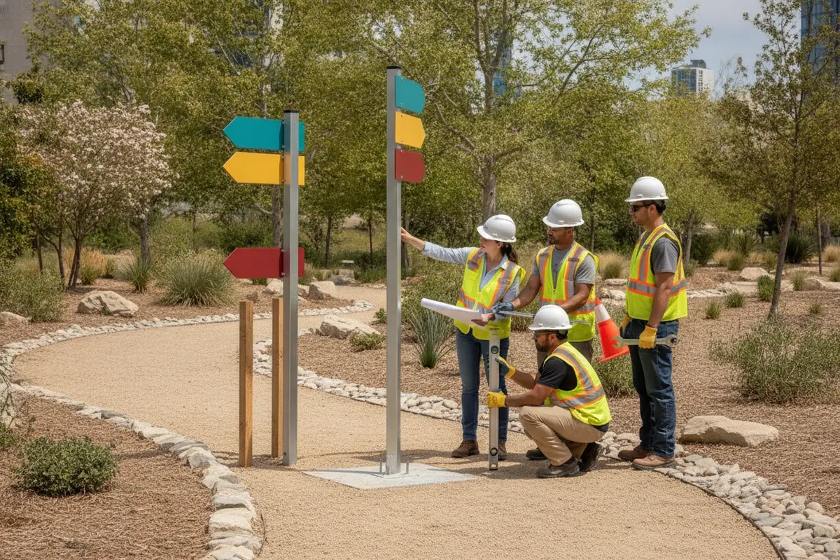
After installation, inspect each sign against the location schedule. Confirm its position, orientation, visibility from the intended approach, message accuracy, finish, and operation where applicable. Photograph completed work and record approved changes, electrical or structural documentation, and service access information in the closeout package. A field review should also check whether nearby landscaping, temporary facilities, or newly installed structures affect legibility.
For a multi-area project, use consistent IDs across drawings, manufacturing records, packing lists, and inspection notes. That basic discipline makes it easier to find an item, confirm its status, and manage corrections without confusing similar signs in different districts. Learn more about how a coordinated professional sign install is sequenced.
How can a park keep signs accurate after opening?
A wayfinding system needs an owner after installation. Assign responsibility for approving destination names, updating maps, reporting damaged signs, and deciding when a temporary message is needed. If content ownership is unclear, signs can drift out of date as operations change, new attractions open, or routes are adjusted.
Create an asset register that connects each sign ID to its location, message, material, installation date, relevant drawings, and service notes. Add inspection frequency based on exposure, use, and operational importance. During inspections, check visibility, attachment, surface condition, lighting or display function, and whether the sign still points to an open and correctly named destination.
Decide how temporary conditions will be communicated. A planned event or maintenance closure may need a temporary route, but temporary messages should not undermine the permanent system. Give staff a defined approval path, use consistent naming and symbols, and remove temporary information promptly when the condition ends.
When a sign must be repaired or replaced, refer to the approved standards and asset record. Replacing one panel without checking the surrounding sign family can introduce inconsistent colors, terms, or arrow styles. A service plan can help the owner coordinate repairs, preserve brand consistency, and keep the route information useful over time. Review signage services in the context of the project's full lifecycle, from initial planning through ongoing support.
What should the project brief and schedule include?
A strong brief gives the design and delivery team enough information to test the system before committing to production. Include a current site plan, intended guest routes, destination list, district terminology, operating conditions, relevant brand standards, accessibility review needs, approval contacts, and known construction constraints. Identify which information is confirmed and which remains under review.
Set review gates for the major decisions. A useful sequence is to approve the circulation plan and sign locations, confirm the message hierarchy and content, review sign types and materials, complete engineering and permit submissions, approve production drawings, then coordinate installation and closeout. The steps may overlap, but the decision owner and required inputs should be clear at each gate.
Allow time for the review work itself. Stakeholders may need to check route logic, brand presentation, code considerations, structural documentation, electrical coordination, or field measurements. A project schedule that includes only manufacturing and installation can miss the decisions that make those steps possible.
Before requesting a quote, gather the information available and note what still needs validation. Carolina Signs and Wonders works on custom, consultation-based projects; a project discussion can establish scope and identify next steps without assuming that every detail is already settled. Explore the sign project portfolio for examples of coordinated signage work, then prepare a brief that fits your property's needs.
Request a consultation for your park signage plan
Frequently Asked Questions
When should wayfinding signs be planned for a new park area?
Begin during site and circulation planning, before paths, structures, utilities, and landscaping are finalized. Early coordination gives the team time to reserve clear sightlines, confirm locations, plan foundations or electrical connections, and align signs with the guest route.
Should every attraction have its own sign?
Not necessarily. Plan signs around guest decisions and confirmation needs. A major destination may need an identifier, while a nearby attraction may be clear from the district sign or directional system. A route review can reveal where additional confirmation is useful and where another panel would add clutter.
How can signs support guests when a route is closed?
Decide in advance who can approve a temporary message, what alternate route guests should follow, and where the detour information must appear. Keep the temporary directions consistent with permanent destination names and remove them when the route reopens.
How often should park wayfinding signs be inspected?
Set inspection intervals based on exposure, use, and the importance of the information. High-use or weather-exposed signs may need closer attention. Inspections should check legibility, condition, visibility, structural attachment, and whether the information still matches current operations.
What information helps a sign partner scope the project?
Share a site plan, intended routes, destination list, project phases, operating constraints, brand standards, known approval requirements, and the names of stakeholder reviewers. Note open questions as well as confirmed decisions so the team can identify needed surveys, engineering, or coordination.
Start a conversation about your wayfinding project
A clear plan connects each sign to a guest need and carries that decision through approvals, installation, and long-term service.


